


On the water. On the way. With canoes, kayaks or board
Canua is perfect for water enthusiasts and all people who love paddling and outdoor activities on the water with canoes, kayaks or SUPs. All water information provided in canua is currently in German language. We are working hard to translate this jewel to englisch as soon as possible.
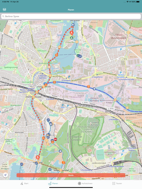
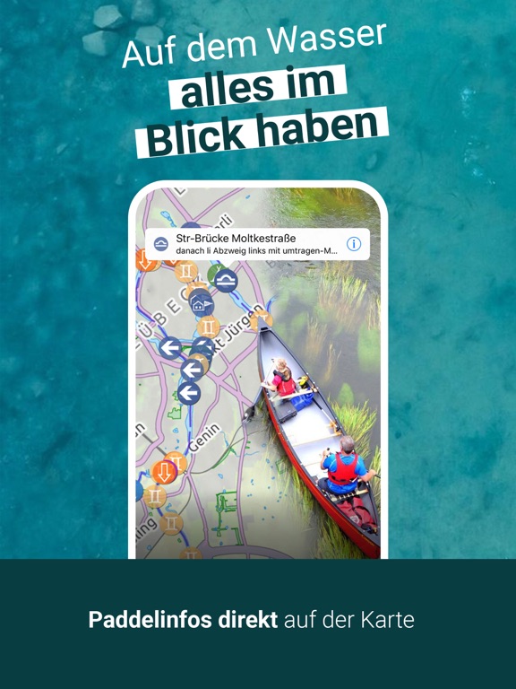
With the interactive map featuring 150,000+ objects detailing water characteristics and paddling conditions, as well as 4,000+ extensively described navigable waterways, you can plan your water tours with Canua. You can record your routes, effortlessly follow the dotted line, and easily share both your route and recorded track with others.
The canoeing database, fully integrated into Canua, is based on the water information found in the printed water guides of the German Canoe Association.
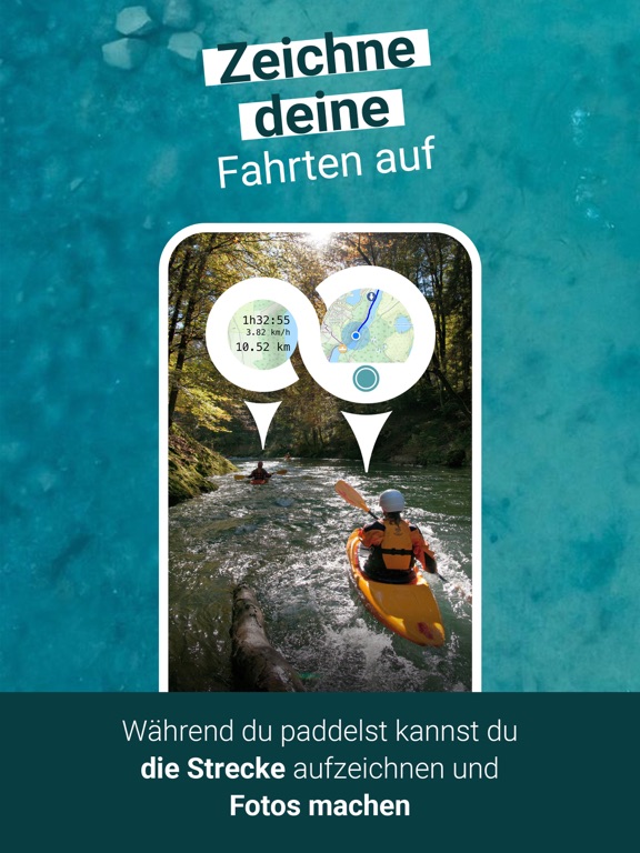
Tracking: Record your tours, monitor your pace and distance covered on the go. Share your trips with others, and even send the recorded trip as a GPX file. Photos taken during the tour will be displayed on the map. For members of the German Canoe Association, tracks can be directly transferred to your electronic logbook.
Canua provides paddle information for Belgium, Denmark, Germany, Estonia, Finland, France, Iceland, Italy, Latvia, Lithuania, Luxembourg, the Netherlands, Norway, Austria, Poland, Switzerland, Sweden, the Czech Republic, Belarus, and more. For example, Corsica and the entire course of the Danube River from its source to the Black Sea are also included and extensively described. Displayed clearly on the map are convenient entry and exit points, weirs, bridges, ferries, power lines, general hazards, rest and overnight options, and much, much more.
Canua offers information about waterway characteristics, gradients, difficulties, obstacles, attractions, campsites, boathouses, and other important details for trip planning, such as accessibility by public transportation. Information on possible restrictions is also included.
PLUS Edition: The premium features in the subscription include:
Offline maps
Offline routing
99 waypoints for planning
Detailed information on over 4,000 waterways in the river guide
Ability to export route planning results to other apps via GPX
Satellite map
Contour lines
Weather forecast during planning
INFORMATION:
Canua requires a GPS signal for navigation, tour recording, and calculating your current speed. Running the recording (GPS-based location detection) in the background may affect your iPhones battery life. Canua is an offering of TouchingCode GmbH. The canoeing database is operated and provided by the German Canoe Association (DKV) based in Duisburg - www.kanu.de. For more information, visit www.canua.info.
Canua also relies on map data created by OpenStreetMap contributors: Data © OpenStreetMap contributors, whom we thank for providing geodata and their great work. Details at http://www.openstreetmap.org/copyright.
The use of the Canua app is subject to the following terms and conditions: https://user.kanu.apmato.com/terms